To see how we got in (and out of) the following, please read the whole post – it’s a long one. In fact, it’s probably the longest post I’ve ever written.

*A 6 hour day that really took 12 hours
*Irazu Volcano
*The bumpiest road ever traveled
*Guayabo National Monument (after it was closed)
*A car-swallowing mud pit
*Fog so thick we couldn’t see the end of the car
*A road that ends by dropping off a cliff
*A dead end road just before where we need to be
*11 hours in the car for 20 minutes of tourism
We got our rental car today. They were nice enough to deliver it to the condo where we’re staying…but they were an hour late getting there. Oh well.
And, they were able to find a GPS unit for us after all. We were really, really happy that they did, because the roads are not labeled here in Costa Rica, and that makes getting places yourself a lot more difficult.
So, we were in the car and we were off. Irazu Volcano is not that far from San Jose. It’s only about an hour, according to everything that we’ve read so far.

So, we were expecting to be there by about 10am. That would give us plenty of time to see the volcano, walk around for a bit, have lunch, and drive another hour to the monument at Guayabo.
–Jonathan had read about the Guayabo monument the night before. It’s ruins from an ancient civilization (around 1500 b.c.) that they are just beginning to excavate. Since we were “so close” we thought we’d pop on over and see them. After all, we’d rented a car, so why not use it?
Well, we got to Irazu fine, but not until about 12 noon. We did run into some traffic in San Jose, but didn’t think it had set us back quite that far.
But, when we got to the top of Irazu Volcano(which is also Costa Rica’s highest point) it was really raining and very foggy at the top, so the park ranger told us that it wouldn’t be worth the entrance fee (10,000 colones per person – $18.00 per person USD).

She said that we could go down a few kilometers and see the museum, have lunch, and see if it would clear up. We’re really glad that the national park authorities don’t work on commission here in Costa Rica.
We went back down, and checked out the museum. We didn’t go in, because it was more than we wanted to spend for a very small (1 room) and privately-owned, museum. We did find a nice restaurant with a great view to stop for a small lunch.
After lunch we thought we’d just head to Guayabo. So, we type it into the GPS. The GPS finds Guayabo, and again we’re off. After another 2 hours in the car, we realize that it just takes twice as long to get places in Costa Rica as you think it should.
But then funny things start happening.
The GPS tells us to take this really steep road. We look at it, and decide that it’s not the best idea to take it. Oh – and it’s not a road, it’s more of a trail with big rocks as gravel. So we go a little further to the next road.
When the GPS tells us to take that one, we can see that it wants us to make a loop – and turn around. So, we turn around instead of following this silly loop on crazy roads.
When we come to another place where it wants us to turn again, it’s another one of those rock trails. While this doesn’t seem right to us, we can see that our destination is at the end of the path, according to the GPS.
So, we take the road.
It is one of the absolute worst roads I’ve ever been on. I took a video of it (which is coming soon), so you can see that, but it’s awful.
The road is so bumpy with holes bigger than any pots I’ve ever seen, and one tire track is on a different level than the other… Then, the GPS wants us to drive down part of the road that is just mud and looks like a horse trail.
We don’t even risk that. Fortunately, the road forked there, so we take the other path. This part of the road is even worse. I literally cannot convey to you just how bumpy this road is.
As we’re driving, I’m thinking to myself that they must not want visitors at the monument if this is the road you have to take to get there. Why would anyone come?
The road is so bad that there is no way most tourists would be willing to go on it.
Right about the time I’m having this thought, the road leads us right to someone’s house.
There’s a small trail that is straight ahead, but it’s more like a footpath through a pasture.
So, we ask the kid playing outside if the monument is right there. He says it’s not. Then, his dad comes over and tells us that yes, the monument is right there, but it’s the back of it. There’s a waterfall there, and if we keep driving we’ll be washed away by the water. It’s really the back of the monument, and there’s no way to get there going that way. He says we have to go back up to the top of the hill (where we turned onto this horrendous road – about 30 minutes back), and go around.
Great. Well, we knew we’d have to drive on it again, but now what?
So we follow the road…and just keep following it, hoping that his directions are right. Just about the time that we think he was wrong, we see a sign. We turn down a dirt road (just a normal dirt road this time), and realize that we’re still about 15 minutes away.
At this point, we’re not following what the GPS is saying, but rather what we’re seeing on the zoomed out map. By this time it’s 3:30, and the park closes at – yep, you guessed it – 3:30.

But, hey, we’ve come this far, we’ve got to at least try, right?
So, we get there, following the normal dirt road, and there’s no one there at the gate. There is a tour bus driver, but he’s clearly waiting for his tour to come back from the park.
We look at the fence, look back at the tour bus, and decide that we’re only 15 minutes late. We climb the fence and we’re off. We see that the path is about 1600 meters to the site where the ruins are.

Right when we get to the ruins, it starts to rain. It’s not that nice drizzly rain. It’s a complete downpour.
For some reason, we only had one umbrella with us (usually we each have one, but today we only had one). So we snapped a few pictures at the ruins – even though we couldn’t really see them very well, and we went back out.
We did get back out before the group of tourists did. We saw them getting on the bus right as we were driving away.
Ahhh the driving. If you don’t think it’s been interesting so far, just wait. It gets better.
I think we should go back the same way we came in, because we actually know how to go out that way now (after the adventure we had coming in).
But Jonathan says that this road is actually a circle, so if we go the other way, we’ll end up on the highway much sooner. Ok, I think. He’s the one who looked up Guayabo and everything about it.
So, with the condo in San Jose being our destination, the GPS guides us. Once again, it has us turn off the main paved road (albeit this main road is pocked with pot holes bigger than a SmartCar), onto a “dirt” trail.

But, it’s not dirt, because as I’ve said, it’s a downpour outside. The road is really muddy, and it doesn’t even look like a road to me.
I tell Jonathan that I’m not really comfortable taking it because I can see that a lake covers the road not far from here. Again, I say that I think we should turn around and take the longer way because we know it, rather than chance all these crazy mud traps.
But Jonathan doesn’t want to. He says we’re close to the highway, so we’ll go this way.
Jonathan gets out of the car and walks past the big lake to see where the road is going to lead before we go down it. I don’t want to drive through the lake to get there. He comes back and says it’s fine.
So, we go.
We drive down the hill and get enough momentum to go through the lake. But, as we hit it, I realize that this mud goes way deeper than it should. The jeep (Suzuki) is literally bottoming out on mud.
Thankfully, we had enough momentum that we just barely squished through it.
There’s always something to be thankful for, especially on Thanksgiving.
We get no further than 100 meters on the other side of the lake, and the “road” stops. Seriously.
It becomes (again), a horse trail through a pasture. I say, again, that I’m not comfortable with the road.
Jonathan gets out, again, and goes to scope it out (I thought he’d already gone the whole way to the main road and that’s why we drove through the lake).
But when he comes back he says “That GPS must have been built for a tank. Only a tank could get through that.”
So, now, what’s our option? Mmhmmm. Go back the way we came and drive back through the lake. Only this time we don’t have a downhill to build up momentum, and we’re in mud, so we already don’t have much traction.

Jonathan is a fabulous driver. Have I mentioned that? Really. He’s great. I don’t know that even Dale Earnheardt could have driven us out of this.
Alright, so we’re faced with the bottomless mud-pit-lake again.
Here we go.
We made it a little more than half way through the lake (there was a small patch of grass to one side that we’re trying to keep the car – oh it’s a Suzuki Jimmy – on. We get stuck (even with 4 wheel drive). So, we throw it into reverse.
We’re still stuck. I offer to get out and push. Then, still in reverse, we start moving, ever so slowly. We inch along, and inch along, and jerk our way through the mud (staying clear of the trees / cliff off the side of the road we’re trying to get traction from).
I don’t know how he does it, but he does. He gets us out of there, and somehow we make it up the mud hill as well.
This time we stay on the main road. Then, we’re finally guided by our POS GPS to a bigger road. But, then this road starts taking us through the mountains.
Well, it’s a good thing that Jonathan has had lots of practice driving in the mountains. Because these roads in Costa Rica have no guard rails, no lines painted on them, and no signs.
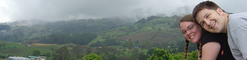
Then, the fog hits. I mean, it hits. One minute, we’re driving along and everything’s fine. The absolute next second, the fog is so thick that we can’t see the front of the car, or the side of the road.
Did I mention that there are buses? Oh yeah… they take up the whole road in the fog. And it’s dark by this time. Guess I forgot to mention that too.
It’s dark, foggy, and there are buses on mountain passes.
Jonathan’s a trooper. He manages to get us safely down and out of the fog.
Perfect. We’re going to get back to the highway! Nope.
The POS GPS takes us off the road in a different direction. We go back up through the mountains, through more fog again. Then it wants us to take another of these crazy rock-path type roads. This time, I try to be more forceful.
I don’t want to take that road, I say.
I’ve had enough of those crummy roads, I say.
I don’t want to take it, I say again.
I’m thinking that it should be all highway from here (which it should be).
But, we take it anyway.
This one keeps getting narrower and narrower. We finally stop after hearing someone whistling at us – loudly and severely. This man comes over, and tells us that there’s a cliff at the end of the road, and we need to go back.
Jonathan makes some motion with his hands implying that he wants to go to the end of the road and turn around. The guy is emphatic in saying something we don’t understand. The gist of it was that there was no way to turn around and that if we tried, we would fall off a cliff.
However, I think that the guy must have been saying something to the effect of “hey goofball… you should have listened to what your wife was saying. There’s NO way to turn around or go anywhere on this road.”
He then directs us to his driveway, so that we can back into it and turn around. We pretty much slide into it backwards on this really steep slope, and kick up some gravel getting back out of it. We’re talking 8-10% grade here. STEEP.
Then, he gives us directions to the next town, which should take us to Cartago, and from there we can get to San Jose.
At this point, we’re wondering why in the world we spent $12/ day on a GPS unit if it’s going to get us this lost. WE could have gotten us this lost by ourselves.
Anyway, we finally figure out that the POS is set to “avoid traffic” and “avoid U-turns’.
This means that if there is any smaller road out there, it wants us to take it. If there’s the possibility that we’ll run into one other car, it has us turn off the road and onto a horse path.
We fix it.
We think that now we’re finally on our way back the direction we need to go.
We’re wrong.
So, they’re building this new highway outside of San Jose. It’s supposed to get you to the beach in 60 seconds. However, it’s not quite built all the way yet.
The GPS doesn’t know this. So, it takes us on it. We follow it blindly of course, because, you know, that’s what it’s there for.
After the road ends, and we exit, we follow it to the condo. Or, at least the way it thinks we should go. The challenge? Another private road, made of rock. Only this one doesn’t end in a cliff. Just a closed and locked gate. Yeah, we can see the condos just a little ways off. (1000 meters or less.)

I don’t know what to do at this point. So, I just start laughing. If I didn’t laugh, I think I would have cried.
Jonathan says he was about to throw a fit and is really grateful for my laughter.
So that turned out well.
By now, we realize that we clearly cannot trust the GPS. So, we go the way we know.
This involves driving back on the incomplete (TOLL) highway back into San Jose (25 minutes), then getting to another highway, turning around, taking the main highway back towards the airport (another 25 minutes).
Then, from the airport, it’s another 20 minutes to the condo.
We finally made it back.
It’s 9:00pm. It’s Thanksgiving. We thought we’d be back by 3:00pm. We stop for some fried chicken and some beer.
We really needed the beer.
Adventures, adventures.
You’ll laugh even more about this someday. So sorry for all your troubles, though.
So many crazy and amazing adventures. This is the meaning of life I think… to have adventures, learn from them, and to really grow into something new and amazing. 🙂